Fair Hill through Google Earth

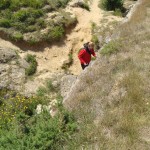
Fair Hill Nature Center was had always seemed a world apart; when you crossed the road bordering my warren-like, wooded neighborhood  and then ducked the brush that lined the other side, like ducking coats in the wardrobe, and emerged into vibrant, open space. From that entrance out of the brush you stood along a well-trod dirt path that wound through an enormous field that rose and fell gently. Going left on the path sent you into woods filled with switchbacks and a trail that snaked up and down a series of hills. The one time my friends and I attempted it while out running, we emerged from the other side of the woods at a fork in the road uncertain which trail to take and chose the center, which turned out not to be an actual trail at all but a deer path. We ended up running through the woods on the narrow side of a cliff, breathlessly tripping over roots, none of us daring to stop.

But going right on that first was the course I was far more familiar with. I loved it best in fall, when running after school would set the light just right against the trees, the leaves ablaze with their new colors. I loved it too when a storm threatened and the sky crowded in gray and close, making details sharper, more cinematic. The trail cut a swath through long grasses, and at the end of the field cut through a brief patch of woods, the path becoming steep and gravelly. On the other side of the woods the path skirted around the bottom of another field before coming to a small creek that you have to hop rocks to cross.  After another stretch of woods, another field, and then woods, there was a big uphill path through a final field before you reached a bridge over the road that bisected the nature center. That was usually the point at which we turned back and went home.

The entire area was always teeming with life: birds calling, tadpoles sitting in pools beside the trails, and, if we ran close enough to dusk, deer grazing and foxes slipping through the trees. Looking at Fair Hill through Google Earth, however, was an absolutely lifeless experience. The land was nearly flat, the colors muted, and all the rich detail was pressed out of the environment. The place I love so much for its uniqueness looks exactly the same as any old stretch of fields from Google Earth. I traveled the entire length of my usual path, but there wasn’t much to see. Even the bird’s-eye view lacked detail, although I was pleased that I could make out the trail itself.

  

Area 51

The myth of Area 51 seemed to grow larger every second I spent exploring it. As I tried to unravel the mysteries surrounding the legendary military base in Nevada, I simply uncovered more and more that both befuddled and captivated my imagination.

The use of the virtual domain that is Google Earth provides us with the unique opportunity to peruse the site; in reality, Area 51 is off limits to a majority of the world, and those who wish to learn of its secrets are forced to admire it from afar, hoping for the chance when maybe, just one, they might see something that justifies their fascination with such an obscure facility.

Contrary to its physical appearance, the virtual image of the complex seems, welcoming, in fact inviting at first glance. The top down view tells many a story, despite its plain coloration, and dreary shading. From afar, the site looks like merely a small airport, nothing out of the ordinary. However, as I moved closer, and closer, and closer, things changed. There were still aircraft on the ground, helicopters, cars, and hangers, however, several minutia stood out to me.
For one, the runways all appear to be the same size (approximately 10,000 ft), which happens to be one of the typical lengths used for United States military operations, except
one. This landing strip is approximately to twice as long as the largest of the other runways. A runway that size would only be necessary for aircraft landing at velocities, proportionally, at least twice that of other aircraft. The only such instance this occurs is with aircraft that operate at speeds well above the speed of sound, such as the Space Shuttle and the SR-71 Blackbird. In addition, on closer examination of the shading of the taxi areas, hangars and the tarmac of the airport, it becomes noticeable that the shading of the environment is off in several places. In fact, it appears as though some elements of the site have been spliced together with images of the same area taken at drastically different periods of time. Considering that Area 51 is rumored (…confirmed…) to be a Government prototyping facility, one can only speculate as to the reasons behind this.

As incredible as it is to finally see the famed location, the simplistic views afforded by Google Earth, or the virtual in general, still cannot compare to actually being there in person. Having one’s physical presence at the site not only allows the beholder to experience the sensation of hearing the sounds of the engines throttling up and the engineers working on them in the hangars, or the pulsating adrenaline coursing through their veins, knowing that they may have the one in a lifetime chance to see something that most of the continent is not even conscious of. Moreover, one can be certain that everything that they perceive is genuine, perhaps stupefying, but nevertheless unaltered.
 

My Journey to the Sonoran Desert

This is my first time to the Sonaran Desert. It is located in the Southwest United States. This place is definitely different than what I am used to. My home in Baltimore City almost never got this hot; even during the summer months on the hot asphault. The sun was showing no mercy whatsoever today. There is no cloud in sight. I barely have enough energy to choke on the sand that finds its way to the back of my throat every time the wind picks up, or a tumbleweed blows by. One thing is for certain, the red clay tastes much better than the tannish colored sand.

Despite being such an inhabitable place, there were quite a few creatures who were more than hostile towards me. There seemed to be rattlesnakes under every rock. Just like me, they were trying to find refuge from this heat. As curious as they seemed, bearded dragons were not afraid to flare their frills at me anytime that I ventured too near their territory. I nearly jumped out of my skin when I saw my first tarantula in the desert. It must have been about as large as my hand. As with any kind of desert, there was always the humble cactus. It still remains as a staple in deserts, especially those out in Western American culture.

I went to the base of a mountain. To my tired eyes, it seemed more like a giant mound of dirt. I could see paintings on the side of it. It was probably drawn with some sort of clay many years ago. It looks a lot like a tribe of Native Americans out hunting. Whatever this masterpiece portrays, I hope that it will remain there in History for other travelers to marvel at. I finally waited a few hours for the sun to go down some before attempting to scale the mountain. There is no way I want to be any closer to the mid day sun than I have to. I reached the top in time to see the sun retreat back under mountains and mesas to the West. The sky was filled with dazzling hues of pink and orange. It was calm and serene like a bouquet of flowers. As I reached the bottom of the mountain, I was met with another surprise. What lie only a few yards ahead of my appeared to be an abandoned town. I ventured closer. I dusted off the sign to one of the buildings to see “Hyder Sheriff’s Department” written in bold red letters.

I was right on the city line for Hyder, Arizona. This is one of America’s ghost towns that was very prosperous in the Old West. The sun was almost set and I could already feel my nerves become tense. The howling wind was nowhere as terrifying as the howling coyote I heard over the mountain I had just trekked. If I ever want to tell others about my discovery of this ghost town, I must make it back home before I become a permanent resident of this place.


Machu-Picchu

It is different, being back here after so long. Machu Picchu, the lost city in the clouds, stretches out before me, tumbling stone terraces tracing down the mountainside, silent corridors free of tourists and not a bird in the air. There is a certain deadness to the space,  an absence of nuance, of imperfection, of humanity.

Huayna Picchu, the neighboring peak, rises behind the crumbling walls of the inner city, looming, and mysterious. Though in my two previous visits, I never got a chance to scale its heights, I can now swoop over the crowning ruins.

As I’m sure will be echoed by many of my classmates, there is an element of novelty and interest generated with the use of the virtualized space, and perhaps even some information. I for one, was not aware of the architecture of the ruins of huayna picchu, and yet, there is a lack of connection in the delivery being whittled down to a single channel. As advanced as the 3D rendering capacity of Google Earth may be, it simply cannot compare to the additional sensations of touch and taste and smell. There is something about being there; feeling the chill, and breathing the thin mountain air. Even the aspects which are uncomfortable only add to the sense of presence.

Google Earth Model of Machu-Picchu (Youtube)

Initially, I was planning on looking at my old home in Nairobi, where I grew up for several years, but another unfortunate flaw in the virtualization of experience is that it is incredibly biased in its perspective of importance. The Western World, and the United States in particular, largely decide what is worth investing energy and resources into digitizing, and as a result, the United States, a large portion of Europe, and a select few world interest sites (read: sites of interest to tourists) and locations are the only regions rendered in any detail. By contrast, my childhood home is represented solely in 2D, and amounts to little more than an oddly stretched, badly artifacted image, and is likely to remain so.

A Digital Exploration of Mitzpe Ramon

Everything about the Mitzpe Ramon, a crater in Israel’s south, was put into perfect perspective as it rendered, somewhat inelegantly, on my screen. At first, upon my initial, vertical approach, I could decipher the Mediterranean sea and Jordan River framing the tiny country. As I zoomed closer still, the contours of the Negev desert in Israel’s south fell into sharper relief. Still, the image was too fragmented to identify the crater itself without the help of the search feature, so I transliterated Mitzpe Ramon into the search box. It appeared close to the point of observation I had found myself at.

The zoom feature then took me to the town adjacent to the crater’s edge. I could recall, vividly, the wind in my hair and the sand in my eyes as I looked out from promendate towards the endless expanse, a feeling notably, necessarily absent from its digital counterpart. The flatness of the town was a stark contrast to the three dimensions in which the crater’s edges were presented in, and I sat digitally where I had physically two years ago, looking out into the rocky expanse.

Although some of the beauty seemed lost in blurriness  I found myself suddenly liberated; I jumped from the tip of the cliff, once so limiting, and soared into the elegant rocky canvass that stretched below me. Every part of this massive crater was suddenly so accessible, every contour within reach. I spied the cars driving between the vallies, the stranger of the geological formations jutting awkwardly from the crater’s center and, as quickly as I had begun my journey  it was at an end. The detail in the rendering left much to be desired and the crater itself seemed suddenly quite small. The fact that it was so easily navigable  but without accessibility on the virtual ground level mitigated that natural gorgeousness; feeling as though you can see everything in front of you is simply tremendous. Now that I could fly there, almost touch every corner, I was somewhat less enthused.

Reading about this place is far more realistic than encountering it on Google Earth. Perhaps an issue with this particular set of photos, the fact that so much seems obscured by pixilation is antithetical to the clarity I felt upon being able to take in the entire crater from one vantage point. Descriptions of the weather and other crucial facets of Mitzpe Ramon were lacking, for obvious reasons, in Google Earth, although I think that their absence truly detracted from the experience. The sun and the shadows it cast could be replicated to some extent using the engine, but still, the render fell far short of the place’s glory, so much simpler to convey through writing. The degree to which I felt I could explore was thrilling at first, but disheartening upon learning that at least on this platform, there wasn’t much to see.


The Digital vs. the Real Hanauma Bay, Hawaii

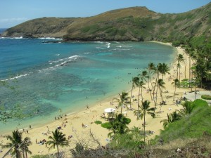
Hanauma Bay, Hawaii, one of the most beautiful places on Earth I have ever seen. Brilliant, pure colors all around: rich greens, gorgeous blues, and bright sand. The above photo was taken by my mother on our Hawaii trip a few years ago. The below is a screenshot from Google Earth.

All color and life has been leeched from this picture. As the camera pans around the giant inlet, only the grandeur of sheer size is preserved. The rest, neglected.

Hanauma Bay State Underwater Park covers 100 acres, and the beach is 2000 feet wide. It is one of the most popular tourist destinations on Oahu Island and accommodates over three million visitors per year.

I still remember that day. My sister and I walked the beach, snorkeled, and sunbathed. We explored through the sand and made deep footprints in the wet muck.

I got a good tan and read one of my favorite books, while feeling the breeze pass by. Watched the wildlife roam in the straw, brown birds, bright birds, and some kind of weasel-ferret thing.

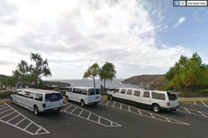
Little details lost in Google Earth. Even the beauty of the reef, gone. You can see the complexity of it, but there is no dimension. It is too flat for a camera on a satellite to pick up, even though there is another whole tiny world in there, one that is only visible from the beach, where automobiles with delicate equipment cannot reach. The nearest street view is from the parking lot, where only the heights can be seen.

At least from the street view, color is not lost. Look at all the shade in just that one tree on the far right. The beach is much more vibrant than even that. Google Earth simply does not do this stunning place justice.

Pointe Du Hoc, France

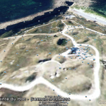
Visiting a battle site feels a bit like trespassing. The rich sands of Pointe Du Hoc stretched out beyond my feet, pockmarked by trenches and spots carved out for large weaponry, radiating with an invisible richness, like each blade of grass among the specks of sand was a story pushing itself out of the earth and asking to be told. The water beat back along the shore, in rhythm with the breeze, cold despite the bright sun. A looming gray rock cliff stands tall in the water, remniscient of the Allied soldiers who once marched proudly across the beach as they invaded Normandy. History surrounds a visitor to a battlefield, yet most stories will lay dormant, scattered in the waves and waving in the breeze, never to be relived.

This is Pointe Du Hoc as I remember it.

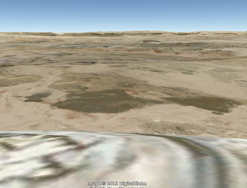
Muir likens exploring a natural space in real life to reading a book. If only it were that easy in the digital world. My first virtual trip to Pointe Du Hoc, France, one of the sites of military action during the Normandy Beach invasion on D-Day, was largely a geometric blur, largely unlike what I remembered of it from when I visited a summer or two ago. My second trip was worse, because Earth was somehow stuck in ground level view, a useless tool for a place with no buildings, and the entire beach was just a flat yellow space with the cliff sharply standing out in the background. I tried to travel around a bit, but the space was incredibly blurred and half-loaded. The photos that others have uploaded to Earth, however, help create a disjointed picture of the place.

Digital exploration, for me, has rarely provided the same experience as actual travel in a place. The sights, the sounds, the smells, the feeling of the wind and the total realization of what role you actually play in your environment has never translated to me through a computer screen, where I feel detached from the surroundings. Yes, you can gather the beauty, or the potential for beauty through the screen, but similar to my argument against e-books, there’s nothing like being there and experiencing it firsthand.Also, the lagginess and the loading, however brief, usually add to the disjointed feeling of the digital exploration.

I think even a textual tour can sometimes be more powerful than a digital tour because it conveys the feeling of a place using every sense, and not just one-dimensionally through sight. There are emotions, there are stories, there are connections between the reader and the place that may not be conveyed otherwise. I am not a person who can just stand and look and feel something – I’m really bad at art museums for that reason – I need to be active and involved, and I think that’s why for me digital worlds are not ideal – they don’t give me much to do besides click around and stare.

There’s certainly no harm to exploring a digital world. For those places we may never get to visit in reality, Google Earth and even Second Life are good, if not interesting tools for exploring the area, getting a feel for what it looks like, what being there might be like. But in my eyes, a digital tour does not provide the same experience as visiting or even reading about a place.

(I’ve included some pictures from when I visited to illustrate what the place actually looks like as compared with the GE version)

Yellowstone: Echo Peak Digital Exploration

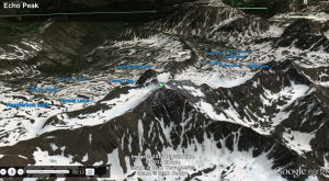
Google Earth pans into Yellowstone National Park, gliding effortlessly over mountaintops to reveal more mountaintops and finally landing upon an aerial view of a carefully preserved natural space. A click on the tour guide option spins a 360 degree view focusing on Echo Peak, the mountainous range is endless and vast. Each peak connecting to the next with rigid lines, softened by a blanket of snow, white and untouched except by nature, defined by the shadows growing out from underneath and flowing along the banks of the mountains.

Using the scroll bar to zoom in farther to ground level view displays a view of the mountains closer to the human perception. I seem to be covered in a thick layer of snow, right in the middle of two hills that seem to grow from the ground as the satellite view continues to form the curves of the terrain and the green, blue hue of the ground. Far into the distance I can discern more mountain peaks, shrinking as they go into the horizon line. The sky is unbounded, filled with gray-blue clouds, stretching across the screen. Sunshine peaks out from the horizon, light shines through the ominous forms in the sky. This is a sight barely seen by the world. At first, I feel overwhelmed by my immediate surroundings, but examining the image before me lets the elements settle in. The sky, the clouds, the mountains, snow, white, green, blue, all form into one. It is a strange feeling; a combination of tranquility and awe, somewhere between being on top of the world and nestled safely within its hands.

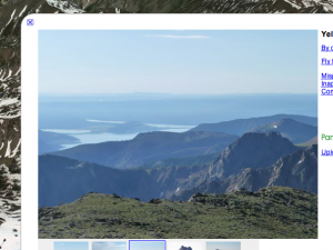
I click on the photos others added to the peaks, struck by the breathtaking images. They show not only the structures shown by Google Earth, but the individual characteristics that give it an identity. The ground the photographer is standing on, the layers of ridges blending as they reach the horizon, with a blue mist fading into the skyline. I can imagine the crisp breeze that comes through every twenty seconds, the serenity of the structures coming over me like a wave of inner peace. While the satellite pan of Echo Peak depicted the scale and vastness of the mountains, these photos truly enhance the features by providing the realistic view of nature. By using both the photos and the tour guide pans of the space, one can easily put together an overall sense of the architecture.

While Google Earth is a great tool to view different places, I also believe that textual visualizations can at times evoke feelings that images are unable to. The words written on a page give the reader the power of their own imagination, while the pixels in a photograph creates a still image. An amazing image will accurately display the area, but text can describe the smell of the trees, the beauty of the snow that glistens under the sun, or the sounds of the breeze tickling the leaves and the wind against ones skin. A good photo can also do these things, but I find that I am never as absorbed in another world when I am looking at an image than when I am reading a passage or book. Google Earth provides a decent representation of these natural spaces, but people are still conscious that they are sitting in a room looking at it on a laptop or an iPad. A textual virtualization has the ability to take one to another realm, many times even beyond reality. It can transport one away from society, and into the heart of nature.

Greetings from Mount Everest

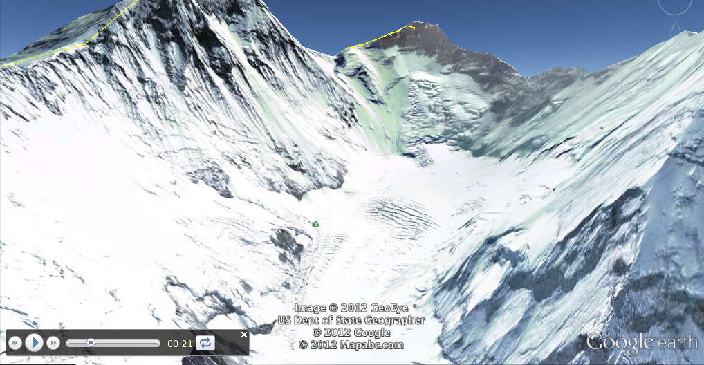
It’s a bird’s eye view of mountains, each dotted with a spot of pure whiteness, patched with limestone-green tints that glisten softly. There must be hundreds of them down there, each in a natural tandem. They mold into one another effortlessly, transitioning from snow-capped peak to snow-capped peak. They know each other well.

The mountains know they don’t have to try; their beauty is obvious. As Google Earth’s tour pans up the mountain’s central snow-filled crevice, two steep and jagged walls greet our peripherals. They are stoic, just as the rest of their mountain counterparts, but with an ego: they know they make up the tallest peak, the Mount Everest itself.

They’re so high that they’re snow-filled and pierce the static blue sky. These mountainous walls seem to whisper, “Try me.”

The peak jumps forward on my screen. The look is exhilarating; it’s one that few have seen live. Just scores of jagged, breathtaking structures, nature’s skyscrapers. It overlooks eons and scores and galaxies of mountains, mountains of the small variety and the tall variety that have stitched centuries of human awe and confusion, mountains as jagged and diverse and glorious as the human race.

A pan out, as I scroll with my mouse and occasionally tap my arrow keys to reach maximum height. A feeling of insignificance hits me after noting the rolling field of mountains on my laptop’s computer, their extension into everything as far as the eye can see. I’m small. They’re large, larger in size than the 10 most powerful people running our world. How does that work? Isn’t bigger supposed to be better? Nothing makes sense when you take a look at the land’s vastness, a superiority unseen by most of the world.

I pan upwards and a blob of white-green-purple-black splashes in front of my eyes. It’s steep and continues to make me feel miniscule. I hit the top. A surprising feeling of satisfaction washes over me. Though I did no such thing, I feel as if I climbed a little bit of it. I saw the top of Everest; I saw the precision, the white-spotted beauty of the most famous mountain in the world.

And while the interface makes you feel like you’re there – in the crevices, on the peaks – I’d argue that it doesn’t feel inherently beautiful. That beauty lies in the hundreds of photos in icons lining Google Earth Everest. After all, Google Earth is a 3D map at heart. A map will show the precise details but isn’t meant to evoke beauty as a photo would – it has logistical aesthetics and simulates beauty, but does not have aesthetic values of beauty inherent to a natural wonder, such as quality of light, clouds, live details. I feel every part of the Everest experience – the idea of being small, awe at details of the structure, exhilaration at the peak – but I’m not struck by beauty when panning the area.

Compared to text virtualizations, Google Earth is very helpful in visualizing the space, its purpose and (most importantly) the feeling that runs through us when we see a site. Words can describe a space – just as I’m doing here – but when you really want to see a space, words cannot match up to the jaw-dropping force of images. For example, when I say “the mountaintop seemed to rise, its white-topped glory dominating the other babies in its midst,” you can visualize it, but Google Earth’s interactive 3D maps help you to feel it, too. Though I can’t see the exact way snow is falling on a mountain, I can understand the power of the space and why we’re drawn to it through elements of height and the panning features.

Travel Log of Preikestolen, Norway

The weather-battered faces of limestone cliffs cover the land while a calm river casually carves its way through the terrain: Preikestolen, Norway is absolutely stunning. I feel as if I have witnessed the power of this landscape simply by viewing it through the pictures of previous travelers. They have littered this virtual land with their photographs of majestic blue skies as they innocently lay on top of the narrow fjord.

Pulpit Rock is a very popular attraction. There are many photographs capturing this landmark during various conditions ranging from overcast to sunny. I keep seeing groups of travelers standing near the edge of the cliff and looking over two thousand feet down into the emerald-blue colored water. This area includes hundreds of miles of trees in a Norwegian boreal forest and a river that seems endless. The pictures covering the land on Google Earth all capture images of a naturally hospitable environment. There are no sudden movements, surprises, or distractions caught by any of the visitors. All of the photographs of the river surrounded by the cliffs have a way of inducing serenity. Now, I feel just as speechless as the rest of the travelers gazing into the beautifully sublime abyss.

Let’s venture into the abyss.

The river is surprisingly flat. It sits as still as the faces of rock surrounding it while clouds move from one side towards the other. If I were on a boat, I would lie down and stare at the sky’s moving panorama. Looking around the area through Google Earth reveals the character of the rock. Their humongous size gives off a feeling of intimidation but the deep green vegetation clings to their steep sides like a newborn baby to its mother: this environment is very nurturing. The absence of distractions allows an explorer to mentally become absorbed into the attractive sites.

With the drag of a mouse Google Earth allows me to easily travel past the river into the depths of Norway’s boreal forest. A few miles away from the edges of tock faces and water reveals a slightly different environment. Images scattered over the map are less numerous. The scenes I do find contain rocky knolls covered in huge stones. Herds of sheep are photographed feeding on the vegetation and innocently moving through the trees like there aren’t any predators in sight. The trees are more vivid and numerous than they were near the river. It’s amazing to see how all the forces within this environment work together to create a tranquil atmosphere.

Although I am not physically in the environment, a few tools in Google Earth allow me to gather important information about the space. The first tool I used was the photo layer. The second was the “street view” option combined with geographic information at the bottom of the screen (location and land elevation). If I were physically in Preikestolen, it would nearly be impossible for me to cover as much area as I did through the software. I viewed miles of terrain with the software’s “street level” view which gave me a general sense of the geography of the land. I then added the photo layer and saw the actual land through pictures that were left on the map by people who had been to the location. These tools worked together to give me a real sense of what travelers experienced when they went there.

A textual visualization is very good at describing an area but it may not capture the feeling of being in the area the same way a digital space can. One example of this is the Pulpit Rock location mentioned earlier. I could describe the color of the limestone, tree patterns, and distance of the river through text. With the Google Earth software however, I can see the landscape through the lenses of cameras that were already in that location. If my curiosity impels me to look closer into the river, I am not restrained by what might have been written. I can move deeper into the river with the software and examine the area much more.