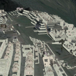
It is different, being back here after so long. Machu Picchu, the lost city in the clouds, stretches out before me, tumbling stone terraces tracing down the mountainside, silent corridors free of tourists and not a bird in the air. There is a certain deadness to the space, an absence of nuance, of imperfection, of humanity.
Huayna Picchu, the neighboring peak, rises behind the crumbling walls of the inner city, looming, and mysterious. Though in my two previous visits, I never got a chance to scale its heights, I can now swoop over the crowning ruins.
As I’m sure will be echoed by many of my classmates, there is an element of novelty and interest generated with the use of the virtualized space, and perhaps even some information. I for one, was not aware of the architecture of the ruins of huayna picchu, and yet, there is a lack of connection in the delivery being whittled down to a single channel. As advanced as the 3D rendering capacity of Google Earth may be, it simply cannot compare to the additional sensations of touch and taste and smell. There is something about being there; feeling the chill, and breathing the thin mountain air. Even the aspects which are uncomfortable only add to the sense of presence.
Google Earth Model of Machu-Picchu (Youtube)
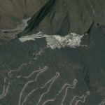
Initially, I was planning on looking at my old home in Nairobi, where I grew up for several years, but another unfortunate flaw in the virtualization of experience is that it is incredibly biased in its perspective of importance. The Western World, and the United States in particular, largely decide what is worth investing energy and resources into digitizing, and as a result, the United States, a large portion of Europe, and a select few world interest sites (read: sites of interest to tourists) and locations are the only regions rendered in any detail. By contrast, my childhood home is represented solely in 2D, and amounts to little more than an oddly stretched, badly artifacted image, and is likely to remain so.


Kanga: You raise two very good points. The first, the limitation of digital spaces because they are only visual, is a good one. And I’m still not sure if I think digital tools can truly create the effect of being in a space. However, we have to keep in mind that language is ultimately just visual as well. It’s worth thinking about how you could overcome this limitation of Google Earth. I think a good place to start would be broaden your experience of this space through a variety of digital tools.
The second point is even more problematic, which is the unequal treatment of spaces based on physical and political geographies. I don’t know that I have an answer to this problem (at least not a short one), but you’re absolutely right to bring it to our attention.