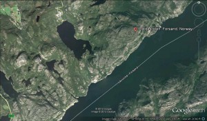
The weather-battered faces of limestone cliffs cover the land while a calm river casually carves its way through the terrain: Preikestolen, Norway is absolutely stunning. I feel as if I have witnessed the power of this landscape simply by viewing it through the pictures of previous travelers. They have littered this virtual land with their photographs of majestic blue skies as they innocently lay on top of the narrow fjord.
Pulpit Rock is a very popular attraction. There are many photographs capturing this landmark during various conditions ranging from overcast to sunny. I keep seeing groups of travelers standing near the edge of the cliff and looking over two thousand feet down into the emerald-blue colored water. This area includes hundreds of miles of trees in a Norwegian boreal forest and a river that seems endless. The pictures covering the land on Google Earth all capture images of a naturally hospitable environment. There are no sudden movements, surprises, or distractions caught by any of the visitors. All of the photographs of the river surrounded by the cliffs have a way of inducing serenity. Now, I feel just as speechless as the rest of the travelers gazing into the beautifully sublime abyss.
Let’s venture into the abyss.
The river is surprisingly flat. It sits as still as the faces of rock surrounding it while clouds move from one side towards the other. If I were on a boat, I would lie down and stare at the sky’s moving panorama. Looking around the area through Google Earth reveals the character of the rock. Their humongous size gives off a feeling of intimidation but the deep green vegetation clings to their steep sides like a newborn baby to its mother: this environment is very nurturing. The absence of distractions allows an explorer to mentally become absorbed into the attractive sites.
With the drag of a mouse Google Earth allows me to easily travel past the river into the depths of Norway’s boreal forest. A few miles away from the edges of tock faces and water reveals a slightly different environment. Images scattered over the map are less numerous. The scenes I do find contain rocky knolls covered in huge stones. Herds of sheep are photographed feeding on the vegetation and innocently moving through the trees like there aren’t any predators in sight. The trees are more vivid and numerous than they were near the river. It’s amazing to see how all the forces within this environment work together to create a tranquil atmosphere.
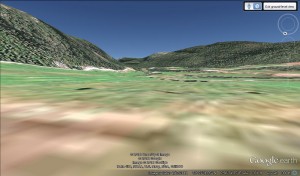
Although I am not physically in the environment, a few tools in Google Earth allow me to gather important information about the space. The first tool I used was the photo layer. The second was the “street view” option combined with geographic information at the bottom of the screen (location and land elevation). If I were physically in Preikestolen, it would nearly be impossible for me to cover as much area as I did through the software. I viewed miles of terrain with the software’s “street level” view which gave me a general sense of the geography of the land. I then added the photo layer and saw the actual land through pictures that were left on the map by people who had been to the location. These tools worked together to give me a real sense of what travelers experienced when they went there.
A textual visualization is very good at describing an area but it may not capture the feeling of being in the area the same way a digital space can. One example of this is the Pulpit Rock location mentioned earlier. I could describe the color of the limestone, tree patterns, and distance of the river through text. With the Google Earth software however, I can see the landscape through the lenses of cameras that were already in that location. If my curiosity impels me to look closer into the river, I am not restrained by what might have been written. I can move deeper into the river with the software and examine the area much more.


Great discussion of the tools Google Earth makes available to the virtual wanderer, Ed! I also enjoyed the sense of serenity that you evoked earlier in your post. That said, I wonder if there’s a way to evoke the danger and action of the natural world through these tools. Perhaps a Second Life location or through some of the linked YouTubt videos? Just something to think about.
Would you like for me to add aome of the things I saw on YouTube to the post? There was one video in particular where a man almost slips into one of the cracks as a helicopter airlifts a car onto the cliff http://www.youtube.com/watch?v=QX7GRfshLw0 (go to 0:48). It made me think exactly about the “danger” and “action” you mentioned. Although the environment is very calm and peaceful, there are still hidden dangers which demand that visitors do not underestimate the power of the landscape.
Nice. I wanted them to drive the car over the cliff.