Muir Woods via Google Earth

In my sophomore year of high school, I took a trip with my family to San Fransisco, California.  While we were there, we decided to visit Muir woods, a national park full of historic California Redwood trees.  Muir Woods is one of the most beautiful, breathtaking places I have ever been.

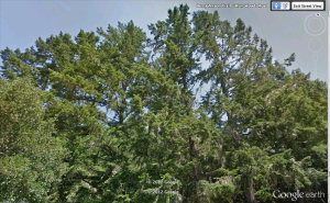
Image provided through Google Earth’s Street View

As I began walking through the woods, I noticed that something felt different.  After walking for a few minutes, admiring the beautiful scenery, I noticed that it was the air.  I took deep breaths, and while the air was a bit chilly, it was so…pure.  I had never truly experienced “a breath of fresh air” until I went to Muir Woods.  Being surrounded by so much nature wasn’t only easy on the eyes, but also on the lungs.  It was as if my body was rejoicing about being in a place simply bursting with life.  I could feel the fresh air enter by body with each breath I took, and when I exhaled I felt clean and refreshed, like the trees were erasing the impurities from my body.

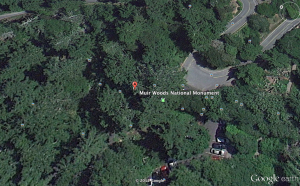
  • Through Google Earth, I can only get a true concept of the space by using the Street View tool.  I can examine the trees that are on the edge of the woods, but I cannot explore deep into the woods where the true patterns of nature are without seeing flat patches of green. To experience the life happening in the heart of the woods, I must rely on pictures that other people have posted, but I cannot physically tour it.  The pictures are beautiful, and the trees stand just as magnificently virtually as they do physically.  But these images are not enough to satisfy me.

Image Provided through Google Earth’s Street View

I was amazed by the trees in Muir Woods.  They aren’t just normal trees–they’re ancient and magnificently tall, like nature’s skyscrapers.  You have to arch you back to see the tree tops.  The leaves dance in the breeze, and the green stands out brightly against the blue of the sky.  The trunks are massive–you could attempt wrap your arms around them, but it’s impossible, and you simply look silly trying.  The trees in these woods are a piece of history, and it’s amazing to think that they have been around for so long.  It’s hard to imagine these bold landmarks as being small saplings at some point.  They stand so tall and proud–they almost appear regal as the sun illuminates them as if they have halos.

  • Through Google Earth, I can still get a good sense of how large these trees are.  Street View and pictures uploaded by other people aid me in my visualization.  The green of the leaves still stands out against the blue of the sky, and their impressive height is still understood.  But because I cam not physically there, I cannot picture how tall the trees are in comparison to myself.  I can see how high up the branches are, but I cannot sense them far above my head.

Image Provided through Google Earth’s Street View

I encountered animals in these woods as well.  I saw deer, chipmunks, birds, and much more.  I remember thinking, “How lucky, these animals must be, to have these magnificent woods as their home.”  What better home could you have?  The air is fresh, the scenery is beautiful, and hollows in the large, sturdy trunks provide good shelter.  And the best part is that it is protected from harm.  This place of beauty and wonder cannot be harmed by the hands of humans.  It truly is a sanctuary, a green paradise away from a world of chaos.

  • If only Google Earth could allow me to explore the heart of the woods, then perhaps I would be able to feel this sense of sanctuary virtually.  Instead I am confined to the edges of the woods by the road, where cars and civilization can still be seen.  There aren’t any animals present, and if there were, they would probably be in danger from being so close to the road. The significance of Muir Woods really isn’t understood through Google Earth.  When streets and cars are in the view, it ruins the idea of tranquility I know I should feel.

Image Provided through Google Earth

Ultimately, going back to Muir Woods via Google Earth is just simply not the same.  While Google Earth is a very useful tool in traveling the globe virtually, it cannot capture the emotions that come with the space.  Through Google Earth, you can utilize the Street View tool to get an up-close picture of the space.  You can see the the trees, and pan the camera up to get a sense of how incredibly tall they are.  But that’s the thing…you can only see it.  You can’t take that breath of fresh air, or feel the impurities leave your body.  You can’t duck your head into a big hollow and hear your voice echo in the massive trunk.  And you can’t feel the strain in your muscles as you arch your back to see the treetops, or the blinding light of the sun once you do.  With Google Earth, you can see the space, but you can’t truly experience it.  This is why I think literature is beneficial.  With literature, while you can’t physically show people the space, you can paint a picture of it with words and phrases designed specifically to help people imagine the place and the emotions that come with it.  What would make a Google Earth tour even better would be if there was some type of narrative that went along with it.  That way, we could see the space virtually, but also feel it as well.


Britannia Range: What The Maps Don’t Tell

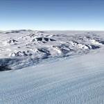
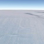
Though it’s at the bottom of the world, the landscape of Antarctica as shown on Google Earth seems as close to the sky as one can get. Here and there, the Britannia Range crests in small rocky spurs, notching the horizon but never daring to fully intrude into the open air. The faint blue streaks that marr the ice give the slightest, uneasy sense of depth, but never clear or close enough to matter. It’s beyond our reach, beyond our caring, and however far down and away the mountains spread is a mystery. We see only the eroded peaks of them

The snow fans out around this modest cluster in every direction, smooth and white as new paper. There is nothing to say about this place – nothing Google Maps finds worthy of mention. But zooming close over the snowfields,you can see the faintest, sweeping shapes where the wind and jagged ice carved light currents over the surface, maps of current too faint us to notice.

It’s hard to speak of here and there when it’s all the same sky overhead, flat and featureless, and the same bleak ground. But where the Britannia Range wrinkles over the surface, the ice crumples and bunches like a cloth as it’s through the pass. What are the spiritless peaks of the Range to this pattern of currents written into the ice? The tracks of its movement seem to send the very sky rushing faster out to the sea. livening the blank sky and the meaningless plain into something starkly poignant.

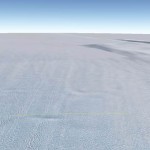
Here, where the ice passes between the peaks, the two planes seem to mirror each other, the deeper blues fading into hard whites, blending into each other until the only distinction between them is the hard line of the horizon. The snow sweeps in cloud-like curves out to the sea while the sky presses down bare and cold as ice. It is a world of mirrors and subtlety and contradiction.

But then, they say there’s nothing here for us to see. The only thing they bothered naming was a huddle of wind-worn stones, no more than sooty spots on the map. There’s no mention of mirrored worlds or currents in the ice. Just a blank spot.

(Sorry, having some issues with the gallery. I can’t get rid of the doubles >_< )

Welcome to the MLK Memorial: Virtual Style

Welcome to Maryland!  This is the sign I see as my mother and brother are getting ready to drop me off at school.  Living and growing up in a small state the majority of your life, you tend to want to get out and explore.  Being such a family orientated person I was hesitant to leave the nest, but when I finally did I was glad I chose Maryland.  Being so close to the city meant being near one of the best known statue’s/park: Martin Luther King, Jr. Memorial!

The Martin Luther King, Jr. Memorial, commonly referred to as the MLK Memorial, stands tall in the heart of Washington Dc.  Never having seen it in person, I figured exploring it virtually would perhaps give me an insightful perspective to what the memorial has to offer.

As I enter the venue and take a look around I am taken aback by the beautiful foliage surrounding the tall standing walls and statues.  Walking slowing to take in all the area has to offer, I see in the distant the great Martin Luther King, Jr. statue.  Approaching it with excitement I begin to pick up my feet and place them one after the other with more haste. After much anticipation I was finally there looking up at the memorial.

Standing there enjoying the view, I begin to walk around the statue.  Not knowing what exactly to expect I turn my head and much to my surprise I see a quote engraved on the left side of MLK himself: “Out of the mountain of despair a stone of hope.”  Knowing all that MLK Jr. did for us the quote speaks volumes and resonates with me for personal reasons.

As I continue to look around the park it is hard not to be drawn to the walls in the backdrop of the MLK statue.  From where I currently stand, although not clear, there appears to be some kind of inscription on the walls.  Anxious to see exactly what the wall has to offer, I move as quickly as possible to reach the wall as fast as I can.  Standing here I am enveloped by the strong words that are presented before me.

The wall of statements and quotes, though it may be hard to tell, are quite powerful to those in their presence.  I feel as if I can tell and feel this way about the virtual memorial then there is not telling how I may react when I finally get to experience in person.

Coming to the end of my venture in DC and departing the MLK Memorial I turn to my right and what do I see…The Washington Monument!  The monument, another well-known landmark in the states, stands tall in the distance to where I stand at the memorial.  Never having seen the monument in person either, I quite glad that I not only got to see the MLK Memorial, but the Washington Monument as well.  At this point, I felt quite accomplished!

Looking at the MLK Memorial from a virtual perspective, I actually feel as if I was there in sense.  Sure, if I were actually there I would have the potential of feeling the wind blowing, listening and looking at other people visiting the memorial and the potential of starting up a conversation as well as being out in the fresh air of nature. Another aspect that I feel is negated from the virtual image is the realness of MLK and the wall behind him.  Sure, I can see it clearly through the digital lens, but if I were to see it in person I feel as if the stone would have authenticity to it that would add even more realness to the statue and add to the overall experience.  Viewing it from a computer screen, I miss out on all of that, but being able to see the memorial and its surroundings through Google Earth definitely makes me want to go so it in person that much more.   As much as our world is becoming consumed in the digital world, not all things can be viewed this way for if they are they lose realness and authenticity, in my opinion, that is!

(Images come to you by means of Google Earth)

Google Earth: Pompeii

Although once under ash from the volcano Vesuvius, Pompeii has been brought into daylight through years of dedication by archaeologists and architectural historians. Now using Google Earth anyone can explore the Roman city from the sky or from the ground. I begin my exploration of Pompeii in the “little theater”, which is actually almost twice the size of the one to the east of it. The rows of seating surrounding the half-circle stage area create a textbook example of the Roman theater. I can see archaeologists continuing the work to recover and preserve the beautiful work of Roman architecture which has been untainted by modern culture. I imaging the ancient stage as it once was, with rotating stone sets, doorways for masked actors to leap to the stage, and an orchestra in front. The theater is filled with people coming to hear the great playwrights of the time perform their latest works.

I continue to a large boulevard with raised sidewalks and a center of paving stones, which was once used for carts. I can see the various building materials of the times displayed in each shop space along the road. On the right, shop walls are made of long, flat bricks or rubblestone. On the left, the wall construction is of heavy masonry and small stone. The most prestigious buildings must have been located on the left side of the boulevard with smaller shops on the right. In fact, the street may have been defined by large stoa, which were open structures for public use including shops and businesses. The street seems to go on for miles, indicating the sheer size of this decimated ancient community.

Rows of partially intact columns and architraves establish the bounds of a temple or government building. The stout structure (if in fact it was only one story) was created in the Doric order and gives the appearance of strength and dignity. The temple stood facing Mt. Vesuvius, perhaps in honor of the great volcano that would inevitable destroy the city.

Another temple or public building, which retained its structural integrity over years buried in ash and rubble, can be viewed from the interior. Even without its second story, I feel the imposing grandeaur of what this space once was. It boasts both the Ionic and Corinthian orders on the interior, with a pattern of stones in different colors as an alternative to fresco and paint. This was once a very important building to the citizens of Pompeii, possibly a meeting place for the local government or a temple dedicated to the god or goddess of the city. Now the open sky above sheds light inside the great space and creates a new reverence for the wonders of the man-made world.

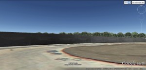
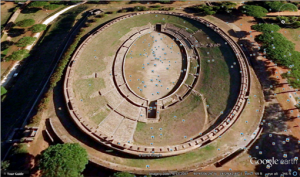
On my last stop I toured the giant Roman stadium. The ellipse-shaped stadium was most likely used for foot races and other events to entertain the citizens and leaders of the city. The stepped seating that remains gives a glimpse into the past: thousands of people would come to watch the games play out below them, cheering for their favorite and throwing gifts to the winners. Three levels of seating separated into wedges by numerous staircases held the masses of spectators. In the absence of a roof, the structure allowed for the natural world to encroach on human civilization and tradition. Natural phenomenon were very important to the Romans and although they were great builders they allowed as much contact with nature as possible in every structure.

Visiting a place like Pompeii through a virtual tool like Google Earth has many advantages. I was able to see the entire city from the air, find patterns and important buildings/spaces, and view the context of the place before going in-depth. The street-level view allowed me to investigate the specific places I found using the “god’s-eye” view in greater detail. The down side to exploring the space virtually is that there is a limit to what you can do. There are many streets and buildings that one cannot access through street view at all.

Fair Hill through Google Earth

Fair Hill Nature Center was had always seemed a world apart; when you crossed the road bordering my warren-like, wooded neighborhood  and then ducked the brush that lined the other side, like ducking coats in the wardrobe, and emerged into vibrant, open space. From that entrance out of the brush you stood along a well-trod dirt path that wound through an enormous field that rose and fell gently. Going left on the path sent you into woods filled with switchbacks and a trail that snaked up and down a series of hills. The one time my friends and I attempted it while out running, we emerged from the other side of the woods at a fork in the road uncertain which trail to take and chose the center, which turned out not to be an actual trail at all but a deer path. We ended up running through the woods on the narrow side of a cliff, breathlessly tripping over roots, none of us daring to stop.

But going right on that first was the course I was far more familiar with. I loved it best in fall, when running after school would set the light just right against the trees, the leaves ablaze with their new colors. I loved it too when a storm threatened and the sky crowded in gray and close, making details sharper, more cinematic. The trail cut a swath through long grasses, and at the end of the field cut through a brief patch of woods, the path becoming steep and gravelly. On the other side of the woods the path skirted around the bottom of another field before coming to a small creek that you have to hop rocks to cross.  After another stretch of woods, another field, and then woods, there was a big uphill path through a final field before you reached a bridge over the road that bisected the nature center. That was usually the point at which we turned back and went home.

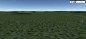
The entire area was always teeming with life: birds calling, tadpoles sitting in pools beside the trails, and, if we ran close enough to dusk, deer grazing and foxes slipping through the trees. Looking at Fair Hill through Google Earth, however, was an absolutely lifeless experience. The land was nearly flat, the colors muted, and all the rich detail was pressed out of the environment. The place I love so much for its uniqueness looks exactly the same as any old stretch of fields from Google Earth. I traveled the entire length of my usual path, but there wasn’t much to see. Even the bird’s-eye view lacked detail, although I was pleased that I could make out the trail itself.


Area 51

The myth of Area 51 seemed to grow larger every second I spent exploring it. As I tried to unravel the mysteries surrounding the legendary military base in Nevada, I simply uncovered more and more that both befuddled and captivated my imagination.

The use of the virtual domain that is Google Earth provides us with the unique opportunity to peruse the site; in reality, Area 51 is off limits to a majority of the world, and those who wish to learn of its secrets are forced to admire it from afar, hoping for the chance when maybe, just one, they might see something that justifies their fascination with such an obscure facility.

Contrary to its physical appearance, the virtual image of the complex seems, welcoming, in fact inviting at first glance. The top down view tells many a story, despite its plain coloration, and dreary shading. From afar, the site looks like merely a small airport, nothing out of the ordinary. However, as I moved closer, and closer, and closer, things changed. There were still aircraft on the ground, helicopters, cars, and hangers, however, several minutia stood out to me.
For one, the runways all appear to be the same size (approximately 10,000 ft), which happens to be one of the typical lengths used for United States military operations, except
one. This landing strip is approximately to twice as long as the largest of the other runways. A runway that size would only be necessary for aircraft landing at velocities, proportionally, at least twice that of other aircraft. The only such instance this occurs is with aircraft that operate at speeds well above the speed of sound, such as the Space Shuttle and the SR-71 Blackbird. In addition, on closer examination of the shading of the taxi areas, hangars and the tarmac of the airport, it becomes noticeable that the shading of the environment is off in several places. In fact, it appears as though some elements of the site have been spliced together with images of the same area taken at drastically different periods of time. Considering that Area 51 is rumored (…confirmed…) to be a Government prototyping facility, one can only speculate as to the reasons behind this.

As incredible as it is to finally see the famed location, the simplistic views afforded by Google Earth, or the virtual in general, still cannot compare to actually being there in person. Having one’s physical presence at the site not only allows the beholder to experience the sensation of hearing the sounds of the engines throttling up and the engineers working on them in the hangars, or the pulsating adrenaline coursing through their veins, knowing that they may have the one in a lifetime chance to see something that most of the continent is not even conscious of. Moreover, one can be certain that everything that they perceive is genuine, perhaps stupefying, but nevertheless unaltered.
 

My Journey to the Sonoran Desert

This is my first time to the Sonaran Desert. It is located in the Southwest United States. This place is definitely different than what I am used to. My home in Baltimore City almost never got this hot; even during the summer months on the hot asphault. The sun was showing no mercy whatsoever today. There is no cloud in sight. I barely have enough energy to choke on the sand that finds its way to the back of my throat every time the wind picks up, or a tumbleweed blows by. One thing is for certain, the red clay tastes much better than the tannish colored sand.

Despite being such an inhabitable place, there were quite a few creatures who were more than hostile towards me. There seemed to be rattlesnakes under every rock. Just like me, they were trying to find refuge from this heat. As curious as they seemed, bearded dragons were not afraid to flare their frills at me anytime that I ventured too near their territory. I nearly jumped out of my skin when I saw my first tarantula in the desert. It must have been about as large as my hand. As with any kind of desert, there was always the humble cactus. It still remains as a staple in deserts, especially those out in Western American culture.

I went to the base of a mountain. To my tired eyes, it seemed more like a giant mound of dirt. I could see paintings on the side of it. It was probably drawn with some sort of clay many years ago. It looks a lot like a tribe of Native Americans out hunting. Whatever this masterpiece portrays, I hope that it will remain there in History for other travelers to marvel at. I finally waited a few hours for the sun to go down some before attempting to scale the mountain. There is no way I want to be any closer to the mid day sun than I have to. I reached the top in time to see the sun retreat back under mountains and mesas to the West. The sky was filled with dazzling hues of pink and orange. It was calm and serene like a bouquet of flowers. As I reached the bottom of the mountain, I was met with another surprise. What lie only a few yards ahead of my appeared to be an abandoned town. I ventured closer. I dusted off the sign to one of the buildings to see “Hyder Sheriff’s Department” written in bold red letters.

I was right on the city line for Hyder, Arizona. This is one of America’s ghost towns that was very prosperous in the Old West. The sun was almost set and I could already feel my nerves become tense. The howling wind was nowhere as terrifying as the howling coyote I heard over the mountain I had just trekked. If I ever want to tell others about my discovery of this ghost town, I must make it back home before I become a permanent resident of this place.


Machu-Picchu

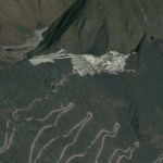
It is different, being back here after so long. Machu Picchu, the lost city in the clouds, stretches out before me, tumbling stone terraces tracing down the mountainside, silent corridors free of tourists and not a bird in the air. There is a certain deadness to the space,  an absence of nuance, of imperfection, of humanity.

Huayna Picchu, the neighboring peak, rises behind the crumbling walls of the inner city, looming, and mysterious. Though in my two previous visits, I never got a chance to scale its heights, I can now swoop over the crowning ruins.

As I’m sure will be echoed by many of my classmates, there is an element of novelty and interest generated with the use of the virtualized space, and perhaps even some information. I for one, was not aware of the architecture of the ruins of huayna picchu, and yet, there is a lack of connection in the delivery being whittled down to a single channel. As advanced as the 3D rendering capacity of Google Earth may be, it simply cannot compare to the additional sensations of touch and taste and smell. There is something about being there; feeling the chill, and breathing the thin mountain air. Even the aspects which are uncomfortable only add to the sense of presence.

Google Earth Model of Machu-Picchu (Youtube)

Initially, I was planning on looking at my old home in Nairobi, where I grew up for several years, but another unfortunate flaw in the virtualization of experience is that it is incredibly biased in its perspective of importance. The Western World, and the United States in particular, largely decide what is worth investing energy and resources into digitizing, and as a result, the United States, a large portion of Europe, and a select few world interest sites (read: sites of interest to tourists) and locations are the only regions rendered in any detail. By contrast, my childhood home is represented solely in 2D, and amounts to little more than an oddly stretched, badly artifacted image, and is likely to remain so.

A Digital Exploration of Mitzpe Ramon

Everything about the Mitzpe Ramon, a crater in Israel’s south, was put into perfect perspective as it rendered, somewhat inelegantly, on my screen. At first, upon my initial, vertical approach, I could decipher the Mediterranean sea and Jordan River framing the tiny country. As I zoomed closer still, the contours of the Negev desert in Israel’s south fell into sharper relief. Still, the image was too fragmented to identify the crater itself without the help of the search feature, so I transliterated Mitzpe Ramon into the search box. It appeared close to the point of observation I had found myself at.

The zoom feature then took me to the town adjacent to the crater’s edge. I could recall, vividly, the wind in my hair and the sand in my eyes as I looked out from promendate towards the endless expanse, a feeling notably, necessarily absent from its digital counterpart. The flatness of the town was a stark contrast to the three dimensions in which the crater’s edges were presented in, and I sat digitally where I had physically two years ago, looking out into the rocky expanse.

Although some of the beauty seemed lost in blurriness  I found myself suddenly liberated; I jumped from the tip of the cliff, once so limiting, and soared into the elegant rocky canvass that stretched below me. Every part of this massive crater was suddenly so accessible, every contour within reach. I spied the cars driving between the vallies, the stranger of the geological formations jutting awkwardly from the crater’s center and, as quickly as I had begun my journey  it was at an end. The detail in the rendering left much to be desired and the crater itself seemed suddenly quite small. The fact that it was so easily navigable  but without accessibility on the virtual ground level mitigated that natural gorgeousness; feeling as though you can see everything in front of you is simply tremendous. Now that I could fly there, almost touch every corner, I was somewhat less enthused.

Reading about this place is far more realistic than encountering it on Google Earth. Perhaps an issue with this particular set of photos, the fact that so much seems obscured by pixilation is antithetical to the clarity I felt upon being able to take in the entire crater from one vantage point. Descriptions of the weather and other crucial facets of Mitzpe Ramon were lacking, for obvious reasons, in Google Earth, although I think that their absence truly detracted from the experience. The sun and the shadows it cast could be replicated to some extent using the engine, but still, the render fell far short of the place’s glory, so much simpler to convey through writing. The degree to which I felt I could explore was thrilling at first, but disheartening upon learning that at least on this platform, there wasn’t much to see.


The Digital vs. the Real Hanauma Bay, Hawaii

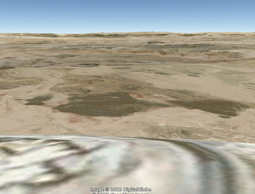
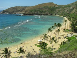
Hanauma Bay, Hawaii, one of the most beautiful places on Earth I have ever seen. Brilliant, pure colors all around: rich greens, gorgeous blues, and bright sand. The above photo was taken by my mother on our Hawaii trip a few years ago. The below is a screenshot from Google Earth.

All color and life has been leeched from this picture. As the camera pans around the giant inlet, only the grandeur of sheer size is preserved. The rest, neglected.

Hanauma Bay State Underwater Park covers 100 acres, and the beach is 2000 feet wide. It is one of the most popular tourist destinations on Oahu Island and accommodates over three million visitors per year.

I still remember that day. My sister and I walked the beach, snorkeled, and sunbathed. We explored through the sand and made deep footprints in the wet muck.

I got a good tan and read one of my favorite books, while feeling the breeze pass by. Watched the wildlife roam in the straw, brown birds, bright birds, and some kind of weasel-ferret thing.

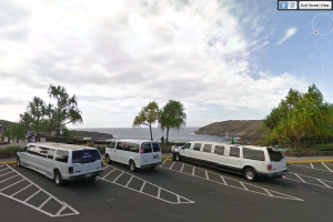
Little details lost in Google Earth. Even the beauty of the reef, gone. You can see the complexity of it, but there is no dimension. It is too flat for a camera on a satellite to pick up, even though there is another whole tiny world in there, one that is only visible from the beach, where automobiles with delicate equipment cannot reach. The nearest street view is from the parking lot, where only the heights can be seen.

At least from the street view, color is not lost. Look at all the shade in just that one tree on the far right. The beach is much more vibrant than even that. Google Earth simply does not do this stunning place justice.