Orange County, Calif. has always been a place with special meanings to me. I still remember the tall peach tree my parents planted in the backyard of our house, the turtle shaped sandbox my cousin and I used to play in and the community swimming pool where my grandma often practiced the freestyle stroke. 14 years later, I have returned to the neighborhood I lived in as a child. This time via Google Earth.
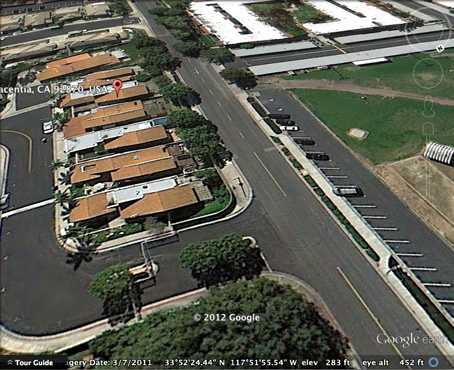
Typing the address of our old house in the search bar, I see the screen zoom in on the deep blue sphere that represents Earth. The screen continues to zoom in, and soon I can no longer see the entirety of the globe. When I arrive at my old home address, everything appears two-D, so flat and deformed that I barely recognize the place. If not because of the high contrast in lighting caused by the sun, I would not even know my current location is California. Thankfully, a few seconds later the street scene and buildings become three-D, and during their two-D to three-D transformation process, memories stream through my mind.
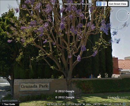
The neighborhood my parents and I lived in is called Granada Park, located in a small, quiet community and with gates in the front and back. Starting from the back side of our old house, I moved along the brick walls that separate Granada Park from the rest of the community. The walls are in slightly different shades of yellowish brown, which reflect the neighborhood’s age. After all, it’s been 14 years since I left here, and Google Earth indicates that these pictures of Granada Park were taken in 2009. But even after such a long time, Granada Park’s beauty is still perceivable. Following the brown walls, I come to the entrance gates. The thin tree on the right of the gates catches my attention with the purple blossoms on its swirly twigs right away. It is not the most breathtaking beauty, yet it sure is something a person would appreciate. The tree stood next to the wooden sign saying “Granada Park,” as if it is greeting anyone who visits.
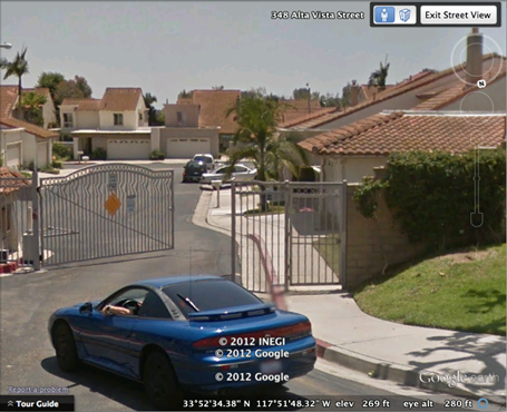
Google Earth shows a blue mid-size sedan entering Grenada Park through the front gates. It reminds me of a familiar scene. Back when I was six or seven years old, I saw my parent wave at the security guard from our car many times per day, asking for permission to enter or leave the neighborhood. Security is highly prioritized, so there are watchmen on both sides of the neighborhood. I try to take a look inside Granada Park by clicking on one of the houses. However, Google Earth wouldn’t zoom in, perhaps because it did not have access to the interior view of the neighborhood.
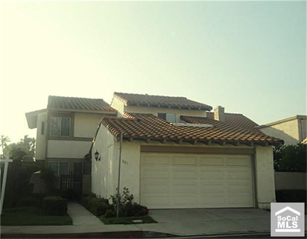
Since Google Earth lacks information about the actual houses, I used Google Images to complement the information I’ve already gathered via the software. Among the countless pictures, a photo of a house in Granada Park looks fairly similar to my old home, with a huge garage and a small wrought iron fence gate on its left. This discovery makes me believe that I have arrived at the last stop of my journey. This was my house, my home. If viewable in Google Earth, there would be a marker placed on the red brick roof indicating my old home address.
Digital media have allowed me to complete this traveling in a short span of time. The experience is positive for sure. I don’t need to spend any money, just some clicking and typing, to get to a place on the other side of the country. Like what Amber Case said, the shortest distance between two points in today’s world is not a straight line, but the overlap of the two points made possible by advanced technology. Digital media have finally transformed us all into cyborgs.


Tess,
It seems like there could be a lot more said about the way Southern California has been made into a digital space. I’d encourage you to explore some additional digital tools as this response feels rather cursory.
Hello Porter,
I haven’t finished writing the article. I just saved it in case some of it gets lost… Somehow I thought I set the visibility to private, but regardless, the complete article will be updated by tomorrow night.
Ah, okay. Great!